
Our review
 Analysis by Lookingapps
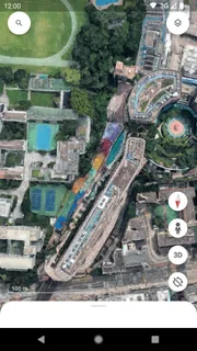
I would install Google Earth for a different reason than I would install a turn-by-turn navigation app. It is at its best when I want to understand a place visually: where a neighborhood sits in relation to a river, how a mountain range shapes a route, or what surrounds a hotel before I arrive. My first useful moment with it was not finding a faster way across town; it was zooming from the globe down to a destination and getting a much clearer sense of its setting.
What the app is good at—and what it is not
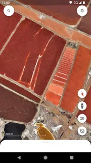
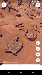
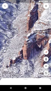
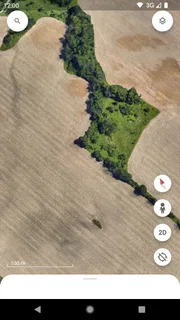
Google Earth is a free travel and local exploration app from Google LLC, available to users of all ages. Its central appeal is the move between a broad view of the planet and a closer look at particular places. That makes it a satisfying tool for curiosity and advance planning, but it is not a replacement for a dedicated navigation app when I need live directions, traffic-aware decisions, or a simple, dependable route while driving.
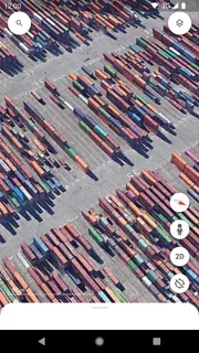
The distinction matters for first-time users. A map app usually answers, “How do I get there?” Earth is more naturally suited to “What does this place look like in context?” I use it to explore a destination before choosing where to stay, to see whether a landmark is tucked into a dense city or set apart from it, and to follow the shape of coastlines, valleys, and urban areas. Those visual clues can make an unfamiliar place feel less abstract.
The app is established enough that it is not a niche experiment: it has more than 500 million installs and an average rating of 3.8 from around 3 million ratings. I take those figures as signs of broad use, not a promise that every device or every location will feel equally smooth. For me, the value depends on whether I want visual exploration rather than quick, step-by-step guidance.
Start with a place you already know
On a first visit, I recommend searching for a familiar landmark or neighborhood rather than beginning with a distant, unfamiliar destination. The familiar reference point makes it easier to judge what you are seeing as the view changes. Once you have located it, pull back and notice the surrounding geography, then move closer again to inspect the local layout. This simple back-and-forth is a better introduction than trying to learn every control at once.
Google Earth is also useful when a place name alone does not tell you enough. A search result may identify a destination, but the surrounding view can reveal whether it sits beside a major road, close to open space, or within a dense stretch of buildings. I would not treat that visual impression as a guarantee about walking conditions or current access. I use it to form better questions and then check practical details with a current map or local source.
Getting set up without making it a project
After installing it, I would give myself a small first task: find a place I plan to visit, inspect the area around it, and save the destination mentally as a reference point for later. There is no need to start with a complicated tour of the planet. The point is to learn how the view responds to searching, zooming, and moving around, so the basic interaction feels natural before you rely on it for planning.
More articles

Instagram Makes Everyday Moments Worth Sharing
A rare social app that can be a photo diary, a neighborhood window, and a lively conversation in the same session—though its best moments still require a little restraint.
For a more useful first session, decide what question you want the imagery to answer. “Is this hotel near the waterfront?” is more concrete than “show me the city.” “What lies between this town and the mountains?” gives you a reason to zoom out and read the larger landscape. This question-first approach keeps exploration focused and helps prevent the common experience of endlessly moving around without learning anything actionable.
Keep in mind that visual detail can vary from place to place. A destination may be easy to recognize from above, while the exact building or street-level context may be less clear than you hoped. I treat the display as a way to understand broad layout, not as a live view of what is happening right now. If a detail affects a booking, an arrival, or a safety decision, I verify it elsewhere before acting on it.
Your first meaningful success: build a mental map
Here is a practical exercise I use before visiting an unfamiliar attraction. Search for the attraction, zoom out until you can see its relationship to the surrounding district, then zoom back in and identify nearby landmarks or open areas that will help you recognize the setting. The result is not a route instruction; it is a rough mental map. When you arrive, you have a better sense of which direction the wider area lies and what the attraction is connected to.
This can be especially helpful when comparing places to stay. Instead of judging a hotel only by its name or a pin, look at the neighborhood around it. Is the area part of a compact center, a spread-out district, or a location near a natural feature? That context does not tell you whether the room is good or whether a particular street feels comfortable, but it can help you spot a location that does not match the kind of trip you have in mind.
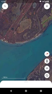
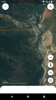
A second useful workflow is to trace a landscape visually before a journey. If you are visiting a coastal town, for example, look at how the shoreline bends and where the built-up area meets the water. For a mountain destination, pull back enough to see the surrounding terrain rather than focusing only on the town label. This gives me a stronger sense of why a place is laid out as it is and what nearby areas might be worth exploring.
The trade-off is that exploration can be more absorbing than efficient. It is easy to drift from the location you intended to inspect into a long session of browsing. I avoid that by setting a specific question and stopping once I can answer it. If my question is simply how to reach a café from where I am standing, a conventional map with route guidance is the better tool.
Common points of confusion
The most important distinction to remember is that an aerial or globe view is not the same thing as live navigation. Seeing a road or landmark in Earth does not, by itself, tell me which route is fastest, whether traffic has changed, or whether a route is suitable for my current mode of travel. I switch to a navigation-focused app when I need immediate directions rather than a better sense of place.
It is also easy to assume that a close zoom means every detail is current or definitive. I do not make that assumption. A visual view can be excellent for orientation while still being the wrong source for checking whether a business is open, an entrance is accessible, or a path can be used today. For those decisions, I look for current information and use Earth as background context.
Another small but useful habit is to change scale deliberately. When a view feels confusing, zoom out rather than continuing to move around at the same close level. The larger context often explains why a destination is where it is and makes nearby landmarks easier to interpret. Then zoom back in with a purpose. This avoids mistaking a local fragment for the whole area.
People who mainly want a route calculator may find the app less direct than they expect. People who want a live, street-by-street picture of a place should also set realistic expectations: the experience is built around exploring the planet visually, not around guaranteeing that every location offers the same level of detail. I would skip it as a primary travel tool if my only goal were to get from one address to another with minimal fuss.
How it compares with ordinary map apps
Compared with a standard map, Google Earth feels more like a visual atlas than a control panel for errands. A conventional map is usually quicker for finding a nearby shop, checking a route, or acting on changing travel conditions. Earth earns its place when a flat map leaves me wondering how a destination fits into the real shape of its surroundings. The two approaches complement each other rather than competing for exactly the same job.
That difference becomes clear when planning a day trip. I might use Earth to inspect the broader area around a scenic stop and understand whether it is isolated or near other places I could visit. Then I would use a navigation app for the actual journey and check opening details separately. This combination is more reliable than expecting one visual exploration tool to answer every practical question.
For casual learning, Earth is also more inviting than a conventional street map because it encourages movement between global and local perspectives. I can start with a region I have heard about and follow its geography down to a destination. The experience is rewarding when I am curious, but less efficient when I already know exactly where I am going and just need the next turn.
Who I would recommend it to
I would recommend Google Earth to travelers who like to preview destinations, students and curious readers who want to understand geography visually, and anyone who finds place names easier to remember when attached to a landscape. It suits people who enjoy asking “what is around there?” as much as “where is it?” Its free price makes it easy to try, and its Everyone age rating means it is presented for a broad audience.
I would be more cautious about recommending it to someone who expects every answer to be immediate and operational. If your priority is live routing, traffic, nearby services, or confirming a business is open, choose an app designed around those tasks. Earth can help you understand the setting, but I would not make it the sole authority for time-sensitive travel decisions.
Google LLC has kept this app around since its release on February 22, 2010, and its scale of use is easy to understand: few things make a distant place feel as approachable as seeing how it fits into the wider world. Still, the average rating of 3.8 is a useful reminder that broad popularity does not mean it will suit every expectation. Its strongest case is focused and clear: use it to explore, orient yourself, and build a visual understanding of places.
My next step after the first session
Once the basic search-and-zoom routine feels comfortable, I would make the app part of a specific planning habit rather than opening it at random. Before a trip, inspect one destination and the surrounding area, note what remains uncertain, and use a more practical source to verify the details that matter. That approach gives Earth a clear role without asking it to do the work of navigation or current local information.
My overall recommendation is simple: install it if you enjoy discovering places through their geography or want a better visual sense of a destination before you go. Begin with a familiar location, ask one concrete question, and zoom out whenever the view stops making sense. Its real strength is helping me understand where a place belongs in the larger picture; once I need live directions or confirmation of current conditions, I reach for a different tool.
Pros
- Explore satellite imagery and terrain across the globe.
- Use Street View to preview many roads and landmarks.
- Search places by name or address with ease.
- Measure distances between locations on the map.
- Save favorite places to revisit them later.
Cons
- Some imagery may be outdated or low resolution.
- Detailed 3D views are limited to selected locations.
- A stable internet connection improves the experience.
- Downloading map areas for offline use is limited.
- Some locations have blurred imagery for privacy reasons.


